Stagecoach Coconino County, Arizona, United States
This has already taken place.Click here to go to the 2027-09-18 event.
Event description
The event begins a few miles north of Flagstaff, Arizona, and finishes in Tusayan, Arizona at the entrance of the Grand Canyon National Park. Course footing varies between single-track, two-track and maintained forest dirt roads.
Runners traverse over a shoulder of Arizona’s highest mountain, Humphrey’s Peak,
through the high alpine meadows of the Hart Prairie Preserve, across 422-square mile
Babbitt Ranches, and along the Coconino Rim where views of the Grand Canyon, Painted
Desert, and Navajo Mountain await.
Course maps
Foot race
|
19 Sep 2026
95.3 mi
Distance
Elevation gain
8,855 ft
Elevation high
7,133 ft
Elevation avg
Course last updated 19 Sep 2026
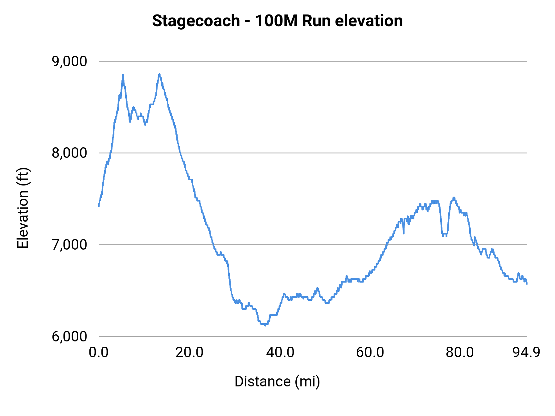
Stats summary
| Race distance | Distance | Ele gain | Ele loss | Ele avg | Paved | Gravel | Dirt | Narrow |
|---|---|---|---|---|---|---|---|---|
| 100M MTB | 95.0 mi | 5,837 ft | 6,673 ft | 7,133 ft | 6% | 71% | 23% | 53% |
| 100M Run | 95.3 mi | 7,192 ft | 8,015 ft | 7,133 ft | 7% | 70% | 23% | 53% |
Event history
Race data contributors